Cape Wrath Trail — four days through the Knoydart wilderness
Six stages on one of Europe's loneliest long-distance trails: from Glenfinnan
through the Rough Bounds of Knoydart — just under 66 kilometres, 1,950 metres of climb.
The Cape Wrath Trail is considered one of the most demanding and remote
long-distance trails in Britain. This section runs from Glenfinnan through the
Rough Bounds of Knoydart in six stages — just under 66 kilometres with 1,950
metres of climb.
What that means: unwaymarked, many unbridged river crossings, no mobile
signal. The Rough Bounds of Knoydart are famous for it — one of the few real
wildernesses Britain still has. Map-and-compass
skill is mandatory; satellite communication isn't a comfort feature here,
it's safety. Build buffer into the plan: two days of heavy rain and the next
river crossing is suddenly unfordable.
The stages
Stage Ia — Glenfinnan to Corry Hully
Glenfinnan valley with the first snow-capped peaks in the distance
Setting off at Glenfinnan — along the riverValley with river between conifer forest and mountain flanksRed deer on the forest track just before Corry Hully
Stage Ib — Corry Hully to A'Chuil
Mountain above the valley — already on the way down to A'Chuil
Beyond Corry Hully — the climb into Glen PeanSun behind the mountain, clouds over the forestSteep slope with a burn and the first ribbons of snowA short break by the burn — snow on the slope aboveBog between bouldersSnowy dip between the ridgesNarrow path through the snow-covered hollowRocky burn with a snow-covered mountain behindA break in the open valley, pack leaning against the trekking poleA moss garden among fallen trunksBurn through the mossy forest before A'Chuil
Leaving A'Chuil — clouds hanging in the mountainsA wild burn through the firs — day 2 beginsWater on the path across a boggy slope in mistBurn cascading over rock stepsMountains in cloud, the path winding through the heatherWaterfall between rocks — close upSmall mountain loch in the valley, clouds clinging to the slopeValley with the burn running over slabs of rockThe rickety wooden bridge before Sourlies — a chunk missing from the load-bearing beam
The load-bearing beams of the large bridge near the end are infested with
dry rot, cracking into cube-shaped blocks.
Stage IIb — Sourlies to the camp by the River Carnach
Tidal flats at Loch Nevis at low tideRocky path above the bayLooking back towards Loch NevisRed deer on the tidal flatsTwo stags crossing the flatsBridge over the River Carnach
With the tide out, I could also have avoided the T2-graded path and its few
small scrambling sections, but without a tide table to hand I chose this route.
You have to pick one. The campsite was wonderful!
Stage III — through the Rough Bounds of Knoydart to Kinloch Hourn
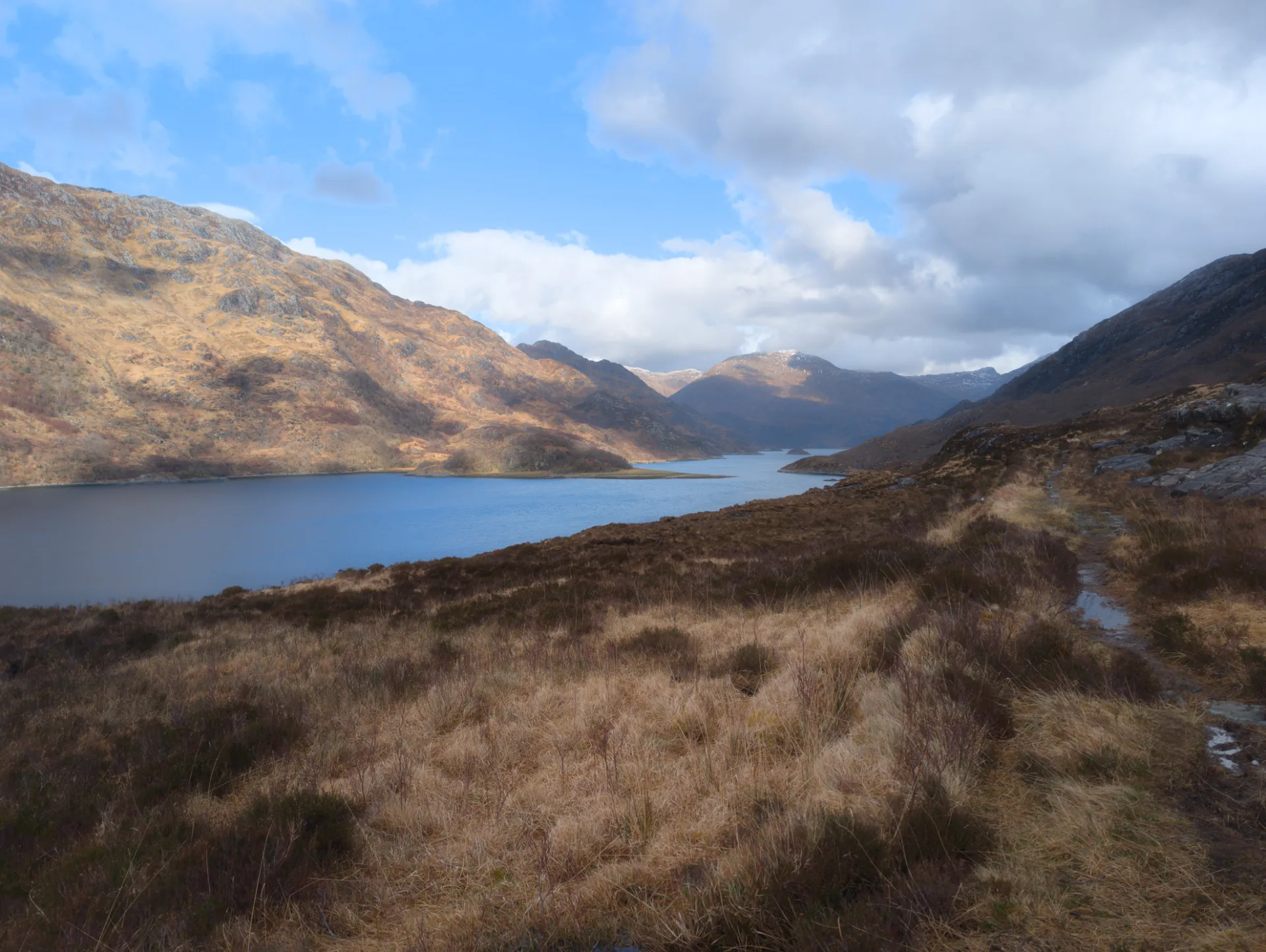
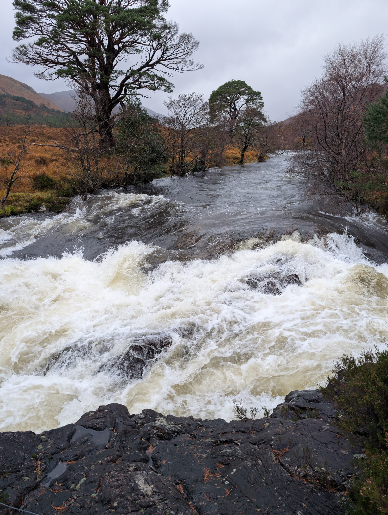
Early morning — waterfall on the slope before the crossingHeading into the Rough Bounds — fully packed, poles in handBurn in the valley just before one of the many fordsImposing cliff alongside the riverBurn in the valley, heather in the foregroundOn the pass — snow in the hollows, otherwise only heather and stoneDescending towards Loch Hourn — the path leads down to the waterLoch Hourn — tidal flats in the sunlightLoch Hourn — classic panorama with snow-capped peaks at the far endLoch shore under dark cloudsA lone bothy on the shore just before Kinloch Hourn
The hardest hiking day of my life — not primarily because of the distance or
the climb, but because of the snowmelt: the burns and rivers were in full
spate, and a missed step or a poorly chosen crossing point would have been
potentially fatal.
After a fantastic night in the tent by the river, a friendly hiker of
Australian descent turned up just as I was setting off. When I asked whether
we might walk a stretch together, he said: "It's always good to have someone
to press the button". He meant the SOS button on my Garmin inReach Mini 2.
Exactly my kind of humour — and a wonderful connection that still holds today.
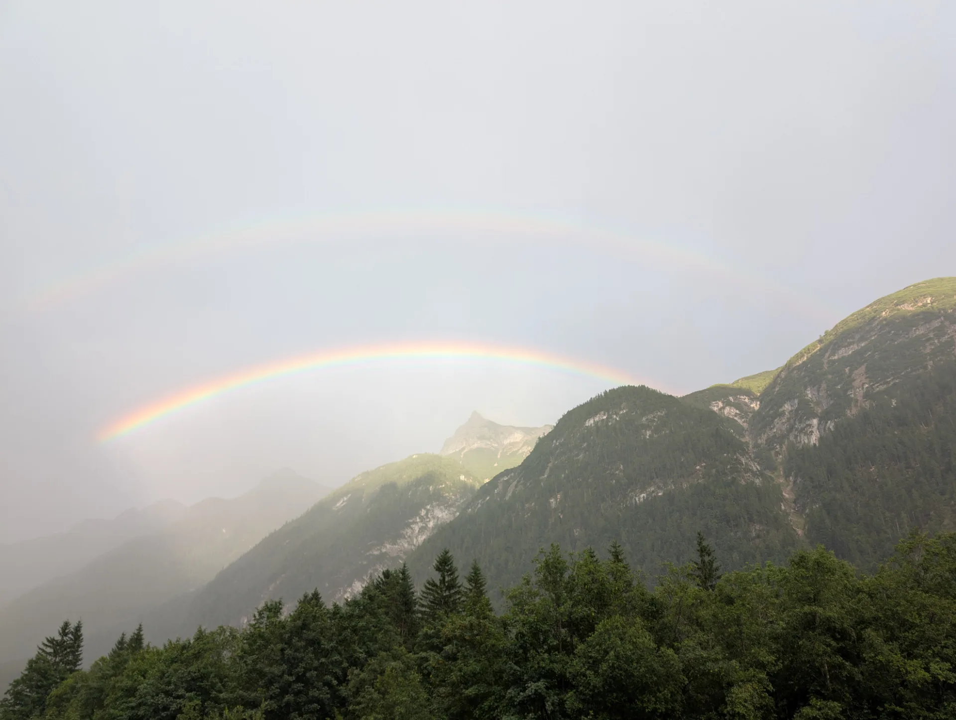
Stage IV — east from Kinloch Hourn
Rainbow over the loch, a solitary house on the shore
Day 4 — looking back across the lochRainbow framed by bare birchesSunny valley with a burn — the weather break holdsMountain hollow with snow stripes aboveBogland with lochans against a snowy mountainWide moor in front of the snow-covered peaksA group of red deer on the slopeLoch with a tiny island in late sunlightStags in the highlands — day 4 ends
Unfortunately Komoot stopped recording in the middle again.
Es ist ein unerwarteter Fehler aufgetreten.
Neu laden🗙
Cookies & tracking
Clicking "Accept" enables Google Analytics (anonymised) for usage stats and the delivery of ads. Both ride on this one consent; there's no separate prompt for ads later. Nothing of this loads without your consent.